|
| |
|
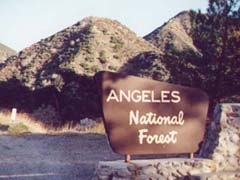
Angeles National Forest
One of the largest National Forests in the United States, Angeles
covers a wide variety of terrain, from deserts to beaches to mountains.
| |
|
| |
|
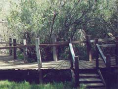
Mescal Wildlife Sanctuary
This wooden path leads to a picnic area under giant pine trees.
Located in the southeast Antelope Valley, near Saint Andrew's Abbey (next
page).
| |
|
| |
|
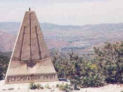
Perspiration Point
Overlooking Acton.
| |
|
| |
|
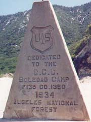
Perspiration Point
Take Hwy 14 to Crown Valley Rd in Acton. Go east on Crown Valley to
Soledad Canyon Rd. Turn left (toward Palmdale) and go to Aliso Canyon Rd.
Turn right and go up Aliso until you see an Angeles National Forest sign
on the right. Near the sign is a dirt road, also on the right. Follow the
dirt road, keep going up. |
|
 |
|
| |
|